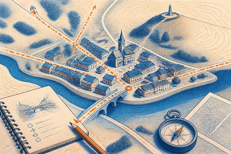
Why a Valley Often Guides the Road
Why a valley often guides the road: learn to read slopes, streams, and bends on a topographic map to explain a route’s shape and its alternatives.
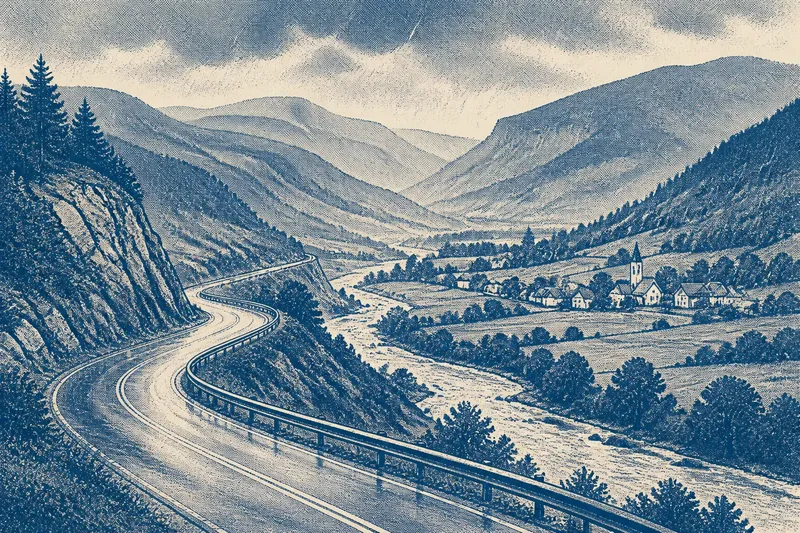
On a rainy drive through the hills, a road may track a stream, bend around a wooded spur, then climb toward a village. A valley often guides the road because its lower ground can offer a gentler passage through higher terrain, though slopes and obstacles determine the exact line. A map makes those choices easier to read.
The valley floor offers a natural corridor
In rugged country, a road must negotiate elevation as well as distance. A valley floor often sits below the surrounding ridges, so following it can avoid the repeated climbs needed to cross higher ground. It is a broad passage, not a ruler-straight line.
A broad valley may leave room for roads, fields, buildings, and a stream. A narrow gorge, by contrast, can squeeze the route between steep slopes and water. The valley’s shape affects where a road can go, but it does not dictate every bend.
Think of the valley as a hallway: it connects places, while furniture and doorways shape the path through it. Cliffs, wetlands, river bends, and settlements can all redirect a road.
Contour lines reveal slopes and benches
Look at the land on both sides of the road. When slopes rise sharply from the valley floor, the usable ground may be limited to a strip beside the stream or a bench farther up the hillside. A bench is a relatively level shelf in a slope; it can give a road room without requiring a climb to the ridge.
On a topographic map, closely spaced contour lines indicate steep ground, while wider spacing suggests a gentler slope. Follow the lines across the road, not just along it. A road that runs beside a contour may stay at a similar elevation; one that crosses many contours is likely climbing or descending.
A road’s bends can also mark a side valley, a rocky spur, or a change of bank. The route may curve to get around an obstruction rather than follow every twist of the stream.
Water and obstacles reshape the route
Streams often occupy the lowest part of a valley, but the road may avoid their immediate banks. Flood-prone ground, a shifting channel, or a marshy flat can make the valley bottom a poor place for pavement. Higher ground nearby may offer a more suitable line, even if the road has to curve.
A rocky outcrop can block a direct path, while a side stream may require a bridge or a different crossing point. Where valley walls draw close, the road may squeeze between slope and water or climb around the narrow section.
That is why similar-looking valleys can produce different road patterns. One may have a wide, relatively open floor; another may be narrow, wet, or broken by tributaries. The corridor matters, as does the ground within it.
Compare the valley with a pass or ridge route
A valley is not always the easiest way to reach a destination. It may curve away from the intended direction, narrow into a gorge, or end below a steep slope. A road over a ridge may be more direct if a low pass provides a manageable crossing.
Compare what each option must cross. Does the valley road keep to a gradual grade, or does it climb around several obstacles? Does the higher route cross one saddle—a dip between higher points—or cut over multiple steep slopes?
Distance alone does not settle the question. A longer valley route may avoid a difficult ascent or repeated stream crossings; a shorter route may work well if the floor is open and the grade stays gentle.
Which map clues explain a valley road?
What makes a valley road easier to follow?
A broad floor and gradual slopes can give a road room to continue without repeatedly crossing high ground. It may still bend to avoid water, cliffs, or unstable ground.
Why does a road sometimes leave the stream?
The stream may run through wet or flood-prone ground, or its banks may be steep. A nearby bench or higher bank can offer a more suitable route.
How can a map show whether the road climbs?
Check where the road crosses contour lines. Numerous closely spaced lines crossing the route indicate steeper ground than a road that follows the contours.
Does a valley always provide the shortest route?
No. A valley can curve away from the destination, narrow into a gorge, or end below a steep slope. A pass or another corridor may offer a more direct way through the terrain.
Read the route in a week of short map sessions
Use an ordinary road map or a topographic map with contour lines, and choose a valley road you can examine without entering a hazardous area. At each stage, note what the map shows and decide what that clue suggests; if a clue is unclear, keep more than one explanation open.
- First session: Trace the road, stream, valley floor, and nearby ridges. If the floor broadens, consider whether it leaves room for a straighter route; if it stays narrow, look for a bench or hillside route instead.
- Second session: Follow the contours around a bend. If they are widely spaced beside the road, consider a gentler slope; if they bunch together, look for a bench or a different route around the steep ground.
- Third session: Mark tributaries, marshy-looking flats, and rocky projections. If one lies across the direct line, consider whether the road bends around it; if none is apparent, check for a slope change or crossing.
- Fourth session: Find bridges and bank changes. If a crossing occurs where a tributary joins or the valley narrows, consider whether that location explains it; if the map gives no clear clue, leave the crossing’s reason uncertain.
- Fifth session: Compare the valley route with the nearest pass or ridge crossing. If the pass crosses gentler contours, consider it a plausible alternative; if it cuts across steep slopes, the valley may offer the easier passage.
- Sixth session: If traveling that way, match visible bends and slopes to the map from a safe stopping place or as a passenger. If the terrain matches, use it to refine your reading; if it does not, check whether the map is simplified or the feature is out of view. Never stop or walk on the roadway to inspect it.
- Seventh session: Write a short explanation naming the corridor, one constraint, and where the road leaves the valley floor. If the map supports a likely reason, state it cautiously; if it does not, describe the bend without claiming to know its cause.
Say you have a topographic map showing a broad valley, a stream at its lowest point, and a rocky spur projecting from the eastern slope. The road bends around the spur, then appears to follow a bench above the stream. First, trace the contour lines: if they stay relatively far apart along that bench but bunch together across the spur, the bench is the gentler-looking option. Next, compare the road with the stream: if the stream-side floor is marked as marsh or the road stays clearly higher, wet ground is a plausible constraint, though the map alone cannot confirm it. The resulting reading is that the road may be using the bench to skirt both the spur and low ground; if the contours do not support that line, treat the bench explanation as uncertain and look for another feature that matches the bend.
Read the terrain without overclaiming
A road’s position offers clues, not a complete account of why it was built there. Bridges, property boundaries, access to settlements, and later changes can also shape an alignment. Use visible landforms to form a grounded interpretation, while leaving room for details the map does not show.
When a road bends through hilly country, trace the valley floor before calling the route indirect. Check where slopes ease, where water gathers, and where the corridor narrows. Those clues often explain why a valley guides the road without dictating every turn.