The Straight-Line Map Myth
The straight-line map myth can mislead northern travelers. Learn how to compare routes by access, travel mode, season, and the crossings they actually need.
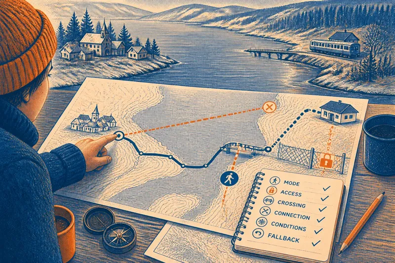
At a kitchen table, someone traces a finger from a lakeside hamlet to a station across a broad inlet. That straight-line map myth makes the trip look simple, but the destination lies beyond water, a private track, and terrain that may change with the season.
For practical route planning, the useful question is not just how far apart two places are. It is whether each segment is open, suited to your mode of travel, and connected to a crossing you can actually use.
A direct line is not a route you can follow
A straight line measures separation between two points. It says nothing about whether a path exists, whether you have permission to use it, or whether it works for walking, cycling, or driving.
On a map, a road may look close to a destination while stopping at a locked gate. A shoreline may appear to offer a crossing, though no public landing exists. The gap between a line and a route is a little like the gap between a shopping list and a meal: the ingredients must still come together in a usable order.
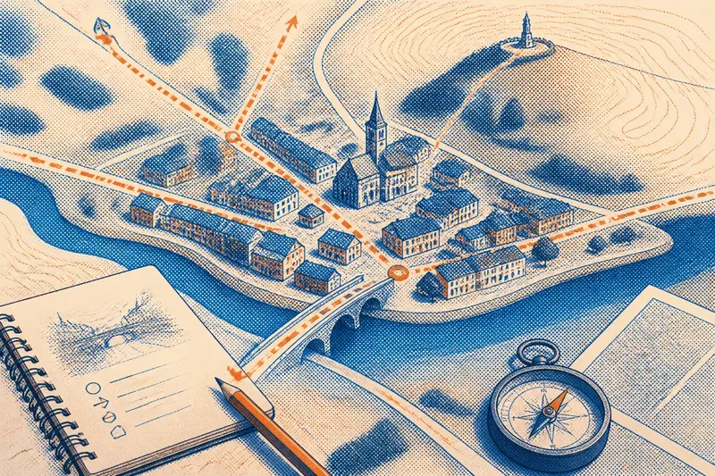
Start by breaking the journey into connected segments. Name the road, trail, transit link, or other route for each part, then mark where one segment ends and the next begins. If a segment or transition has no clear answer, treat it as unresolved rather than assuming you will work it out on the spot.
Route planning depends on access and travel mode
Different modes can require different routes between the same places. A road may be open to cars but unsuitable for pedestrians; a trail may be fine on foot but closed to bicycles. A ferry or bridge can connect the map’s two sides only if it serves your intended travel mode and is available to the public.
Check the map legend and current local information for access rules, closures, and crossing details. Pay attention to the exact transition: a road that reaches a riverbank does not by itself tell you how to cross the river.
Say you are planning an invented walk from a hamlet to a station across an inlet. Your map shows a road to the water, a bridge farther along the shore, and a track beyond the bridge. You check a current local map and learn that the track is private, while a public footpath reaches the station from the bridge. You choose the footpath and plan to return the same way if it is closed; the resulting route has a confirmed crossing and a public walking connection, rather than an assumed shortcut.
Seasonal conditions can change a route’s suitability
Weather and season affect what a route asks of you. Snow can hide trail edges and drainage channels; rain or snowmelt can make low ground difficult; ice can turn a familiar crossing into a serious hazard. A route shown on a map is not a current condition report.
Before setting out, check local notices and forecasts relevant to your route, including closures and crossing conditions. If safe passage depends on ice or another hazardous condition, follow local authorities’ guidance and seek qualified advice where needed. Do not treat a map as evidence that a crossing is safe.
Keep a fallback that does not depend on the uncertain segment. That could mean another confirmed public route, a return to your starting point, or postponing the trip if no suitable option remains.
How can you compare routes before setting out?
What does straight-line distance tell you?
It shows how far apart two points are without accounting for the path between them. It cannot tell you whether a route is open, passable, or appropriate for your mode of travel.
How do I know whether a crossing is usable?
Look for a named or marked bridge, public ferry, or other authorized crossing, then check current access and service information. A nearby bank or road endpoint is not enough to establish that you can cross.
What should I check for a walking route?
Confirm that each segment permits pedestrian use and connects to the next one without an unplanned gap. Check current closures and conditions as well, especially where weather could affect passage.
What should I do if a segment is uncertain?
Find a confirmed alternative or plan to turn back before reaching the uncertain point. If neither option is suitable, postpone the trip rather than relying on an improvised crossing.
A route check turns map clues into decisions
Use this list to decide whether the route is ready to follow. An unresolved item calls for an alternative, a local check, or a change of plan—not a guess.
- Travel mode: Check whether every segment allows walking, cycling, or driving as intended; if it does, keep that segment, but if it does not or the rule is unclear, find a permitted alternative.
- Public access: Check whether roads and tracks are open to the public; if access is confirmed, include them, but if a gate, private status, or restriction blocks passage, choose another public route.
- Crossing: Check for a named, authorized crossing that serves your mode; if it is confirmed and available, use it, but if it is missing or closed, route to another confirmed crossing or turn back.
- Connection: Check that each segment joins the next at an accessible point; if the connection is clear, continue planning, but if there is a gap, add a verified link or reject that route.
- Current conditions: Check local notices and weather for issues affecting the route; if conditions are suitable, proceed with the plan, but if a closure or hazard is reported, choose a safer option or postpone.
- Fallback: Check whether you have a confirmed alternative or a safe return plan; if you do, keep it available, but if you do not, identify one before leaving or postpone the trip.
The straight-line map myth is useful to remember precisely because it exposes what a line leaves out. For practical route planning, check the links between segments, the access rules, and the current conditions before distance decides the route for you.