A Map Walk Through an Older Town
An older-town map walk helps you trace visible changes in streets and blocks, compare maps carefully, and describe a town’s shape without overclaiming its history.
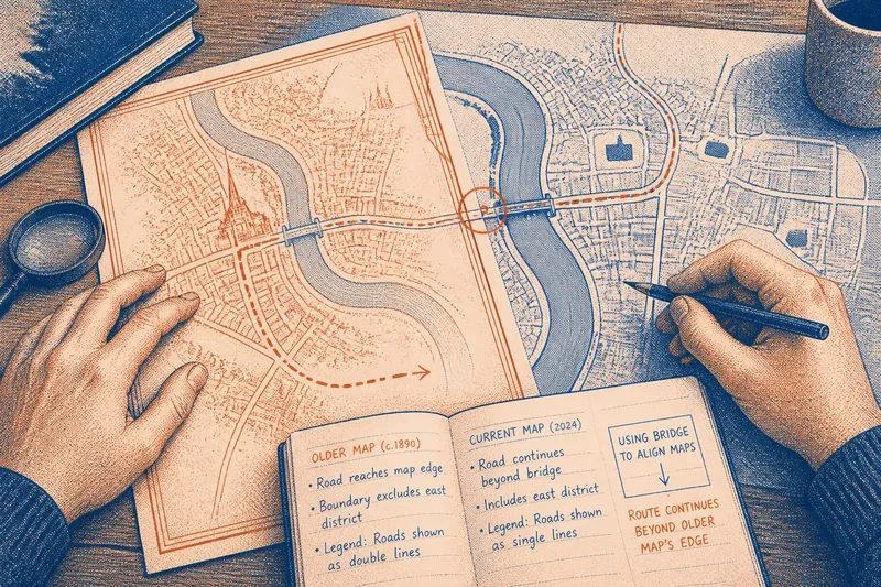
At a library table, you unfold an older-town map and find a street continuing past the edge of the page. An older-town map walk can turn that small puzzle into a close reading of the map itself: its frame, symbols, gaps, and changing level of detail.
Begin with the map’s frame and date
Before tracing streets, check the title, date, legend, north arrow, and map boundary. These details tell you what place and period the sheet claims to represent, which features it distinguishes, and where its coverage stops.
A street that disappears at the paper’s edge may continue beyond the survey. A blank patch might represent open ground, an omitted feature, or an area the mapmaker chose not to show. The frame is part of the evidence, not just a border around it.
If you have a current map and a historical one, use a shared landmark such as a river bend, bridge, or church to orient them. Think of that landmark as a thumbtack holding two transparent sheets in place: it helps you compare locations without assuming the maps use the same scale or conventions.
Read the map as a record of choices
Maps do not show every part of a town with equal detail. One sheet may emphasize roads and property boundaries; another may highlight public buildings, rail lines, or waterways. A missing label or faint line can reflect the map’s purpose and limits rather than a feature’s absence on the ground.
Notice how the cartographer draws a street: as a centerline, a pair of edges, or a broad band. Check the legend before comparing widths or symbols, since the same visual mark can carry different meanings on different maps. Record what is drawn first; save explanations for later.
Trace continuity instead of searching for a single origin
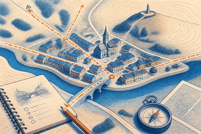
Choose a route across the sheet and follow it carefully. Note where it changes direction, meets another route, crosses water, or ends at the map frame. This method keeps attention on visible connections rather than turning one prominent spot into a claim about where a town began.
Look for differences between maps in the same location. A lane shown on an earlier sheet but not a later one may have been removed, renamed, or left outside the newer map’s scope. A new line may represent a built route, a planned road, or a revised drawing convention; check the legend and date before choosing among those readings.
Street names can help you find matching routes, but names may change or appear in different spellings. Copy the form printed on each map, then note any modern name separately. That preserves a useful comparison without treating a name as a complete account of the street’s past.
Use the map’s edges to test what it can show
Inspect the boundary on every side. Does a route meet the edge at an angle, stop just before it, or run parallel to it? Does the map include nearby fields, water, or only the built area? Such details can reveal whether a visible cutoff belongs to the place or to the sheet’s coverage.
Compare the printed boundary with another map when possible. If the street carries on beyond the first sheet, the apparent ending was a limit of coverage. If it ends in both maps at the same mapped feature, you can describe that relationship—but avoid assigning a cause the map does not provide.
What questions help you compare older-town maps?
How can I tell whether a street really changed?
Match the maps using stable features such as a bridge, river bend, or public building, then compare the same stretch of route. If the map dates, coverage, and legends differ, describe the visible change while leaving open whether it reflects the town or the way it was mapped.
What does a blank area on an old map mean?
It may show open land, an area outside the map’s subject, or a feature the cartographer did not include. Check the legend, title, and surrounding detail before treating the blank as evidence that nothing was there.
Can a map’s scale help me compare street widths?
Only with care: maps made at different scales or with different drawing conventions may depict the same street differently. Compare the legend and scale bar, and prefer descriptions such as “drawn more broadly” over claims about actual width when the sources are not directly comparable.
How should I handle a street with different names?
Write each name as it appears on its map and note the map date beside it. If the routes align, you can say they occupy the same mapped corridor while leaving the reason for the naming change unresolved.
Record observations with decisions attached
For each feature, write what you see and what you will do next if the evidence points one way or another. This keeps a map walk practical: an observation becomes a decision about comparison, description, or uncertainty rather than a loose guess.
- Map date: Check the printed date; if it is present, compare it with the other map’s date, and if it is absent, describe the sheet as undated rather than assigning it a period.
- Map boundary: Check whether a route touches the frame; if it does, inspect a map covering the adjoining area, and if it does not, record the point where the route is actually drawn to stop.
- Legend: Check how roads and open spaces are symbolized; if the symbols are explained, use those terms, and if they are not, describe their appearance without naming their function.
- Shared landmark: Check for a feature visible on both maps; if one aligns clearly, use it to orient the comparison, and if none does, avoid claiming precise correspondence between routes.
- Street name: Check the spelling and label on each sheet; if names differ, record both with their dates, and if a name is absent, compare the route’s position without supplying one.
- Route continuity: Check whether the line joins another route, crosses a feature, or stops; if the same connection appears on both maps, describe it as continuous in both, and if it differs, note the discrepancy and check coverage before interpreting it.
- Scale and drawing style: Check the scale bar and how streets are represented; if the maps are comparable, discuss the drawn pattern, and if not, avoid conclusions about relative street width.
Imagine you are comparing a historical sheet with a current street map. Both show a bridge over the same river bend, so you use the bridge to line up the area; the older sheet’s road reaches the paper’s edge, while the current map carries it farther. You check the older map’s frame and see that it excludes the adjoining district, so your resulting note is that the route continues beyond the historical sheet—not that the town’s road ended there.
Keep the account within the map’s limits
A compact cluster of streets, a broad avenue, or an irregular lane pattern can be described directly. Those features do not, by themselves, establish who lived nearby, what work took place there, or why a route took its shape. Questions like those call for other evidence.
The most useful older-town map walk is specific about what each sheet makes visible: where lines meet, where symbols change, and where coverage stops. For an older-town map walk, the map’s boundary can be as revealing as its streets, because it shows exactly where observation must give way to a question.